.jpg)
This general view of Rouen from 1847 depicts the activity of a modernized city, whose commercial port is, still at that time, in its very heart. The goods that pass through its quays supplied the factories on the left bank, whose chimneys can be seen in this work, along with the lower Seine valley area and the Paris region.
ROWBOTHAM, Thomas Charles Leeson (1823-1875)
General view of Rouen from Bon Secours (Bonsecours),
Londres, 1847
Watercolor with gouache highlights on paper
Rouen, Musée des Beaux-Arts de Rouen, Département des Arts Graphiques – RMM, inv. AG.2006.3.1
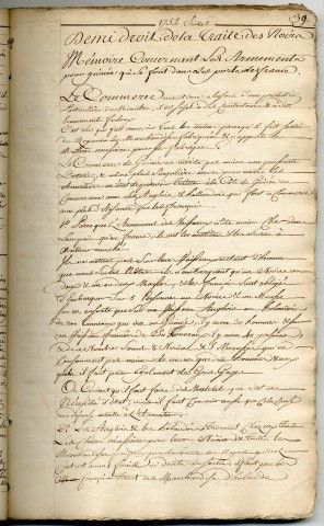
Cahier-registre des correspondances des négociants du Havre,
Le Havre, 1749-1772
This print is based on the design painted on the dome ceiling of the Grand Theatre de Bordeaux. The allegory chosen is a triple tribute: to the arts, to the builders of the theater, and to the city of Bordeaux. At the foot of the city, represented by a woman protected by Athena and Hermes, lie the riches that ensure its prosperity: maritime trade, wine, and slaves.
Noël Le Mire (1724 - 1800), after Jean-Baptiste-Claude Robin (1734 - 1818)
Apollo and the Muses accepting the dedication of a temple devoted to them by the city of Bordeaux
1782 Print, diameter 75 cm
Bordeaux, Musée d’Aquitaine, Accession No. 88.31.1
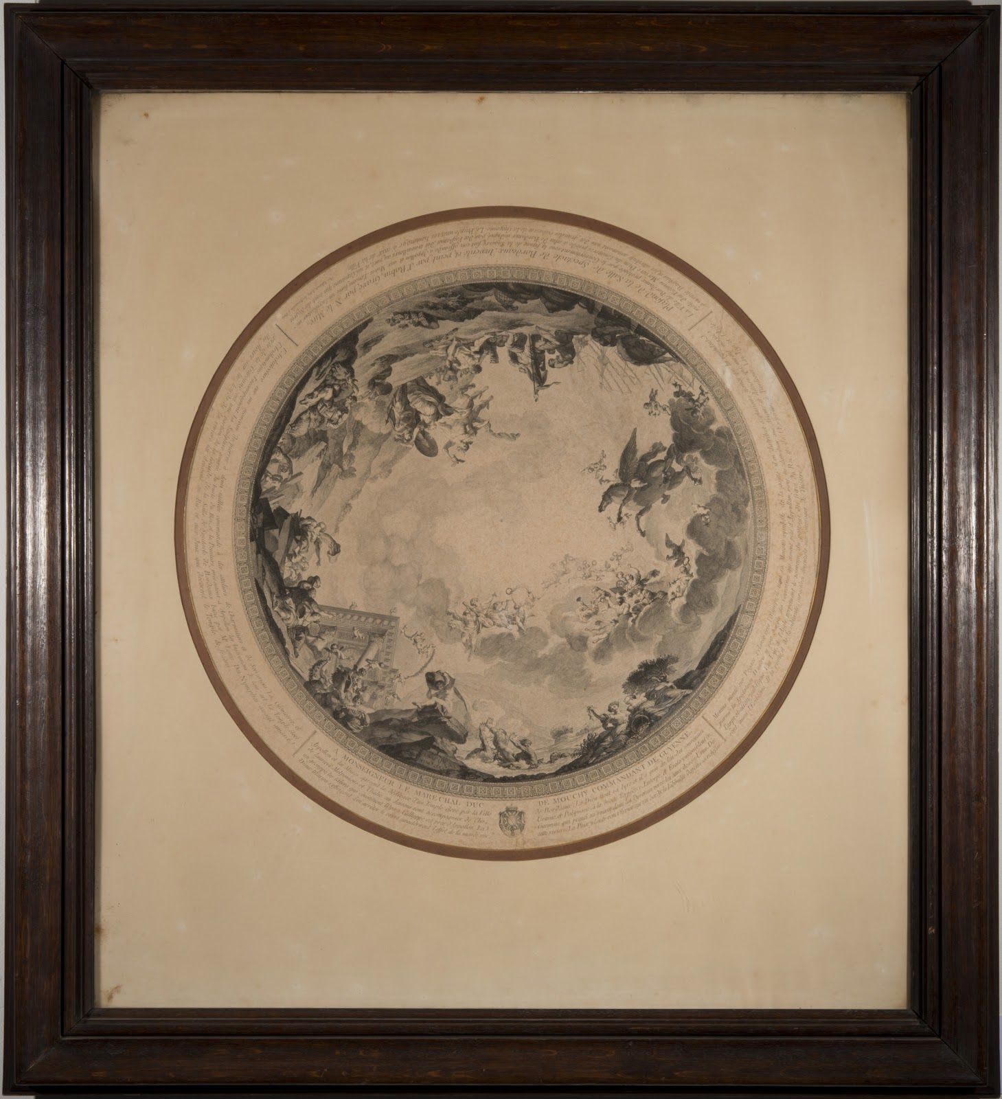
Noël Le Mire (1724-1800), d'après Jean-Baptiste-Claude Robin (1734-1818) Apollon et les muses agréent la dédicace d'un temple élevé par la ville de Bordeaux 1782 Gravure, Diam. 75 cm Bordeaux, musée d'Aquitaine, inv. 88.31.1
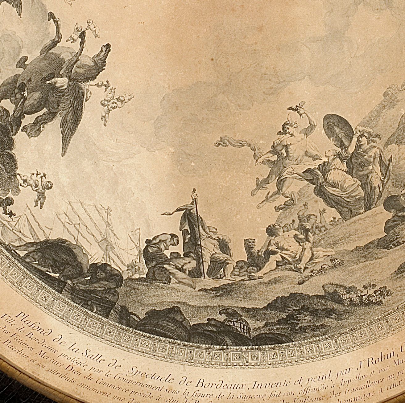
détails du plafond
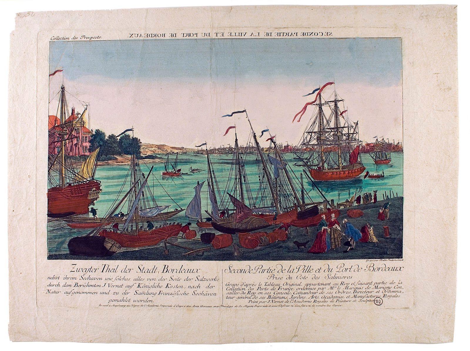
Optical view engraving after the original painting belonging to the King and forming part of the ‘Ports of France’ collection, commissioned by the King’s Counselor, the Marquis of Marigny.” In the 18th century, the French merchant fleet grew, and trade with the West Indies intensified. By the end of the century, Bordeaux was a major slave port, second only to Nantes.
Unknown, after Joseph Vernet (1714 - 1789)
Second view of the town and port of Bordeaux from the Salinières Late 18th century Etching on laid paper, 36 x 48 cm
Bordeaux, Musée d’Aquitaine, Accession No. 63.88.23
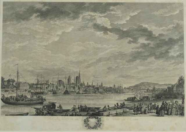
This engraving highlights the distinctive feature of the commercial port of Rouen. Divided by a floating bridge between 1626 and 1836, the city had a maritime basin, downstream of the bridge, where deep-sea ships came in from Le Havre, and a river basin, upstream of the bridge that harbored the river boats used for the unloading of goods and their transport to Paris. As a hub for trading and traffic, Rouen had close links with the countryside.
After a drawing by COCHIN, Charles-Nicolas known as Cochin le fils (1715-1790)
View of Rouen from the Left Bank Rouen, 1777
Etching and engraving on white paper
Rouen, Musée des Beaux-Arts, Département des Arts Graphiques -RMM, inv. AG.1939.9.1
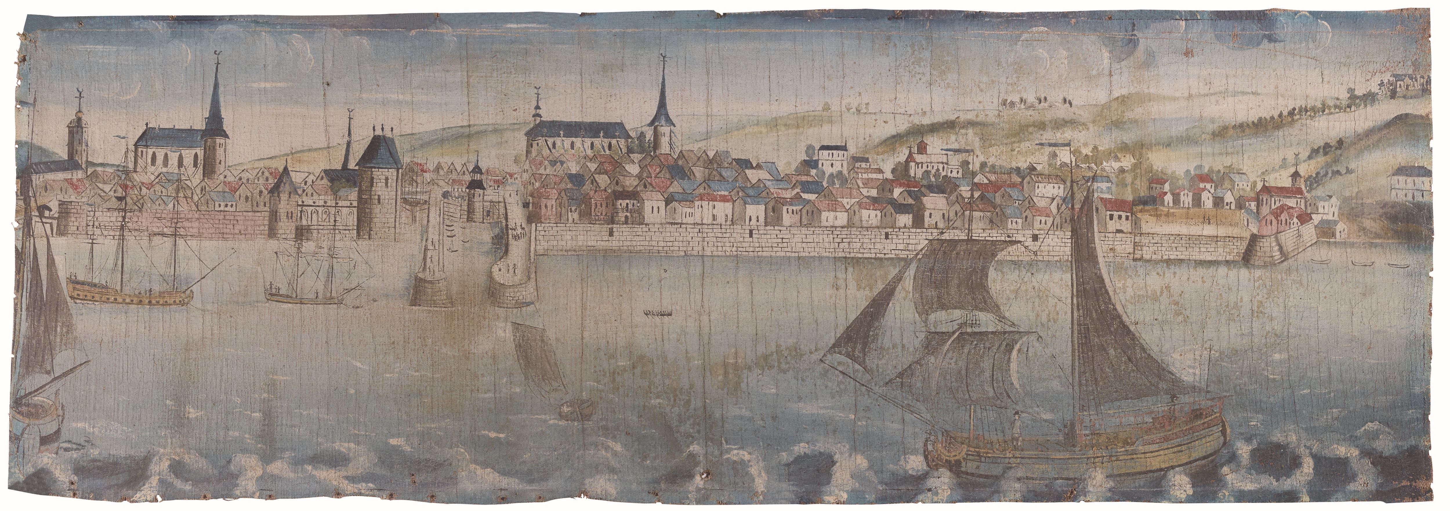
Panorama de la ville de Honfleur, de l’église Saint-Léonard à l’extrémité du Cordon royal,
18th century
Oil on canva, 36,8 X 105,5 cm,
Musée de la Marine, Honfleur, INV.39.93
©Illustria

MOITHEY, Maurille Antoine (1732-1810)
Plan de la ville et fauxbourgs d’Honfleur (telle qu’elle étoit jusqu’en 1770),
End of the 18th century
Etching on copper, 20,8 X 29,3 cm (au coup de planche),
Musée Eugène Boudin, Honfleur, inv.2003.21.6
Donation from la Société des amis du musée Eugène Boudin
© Illustria
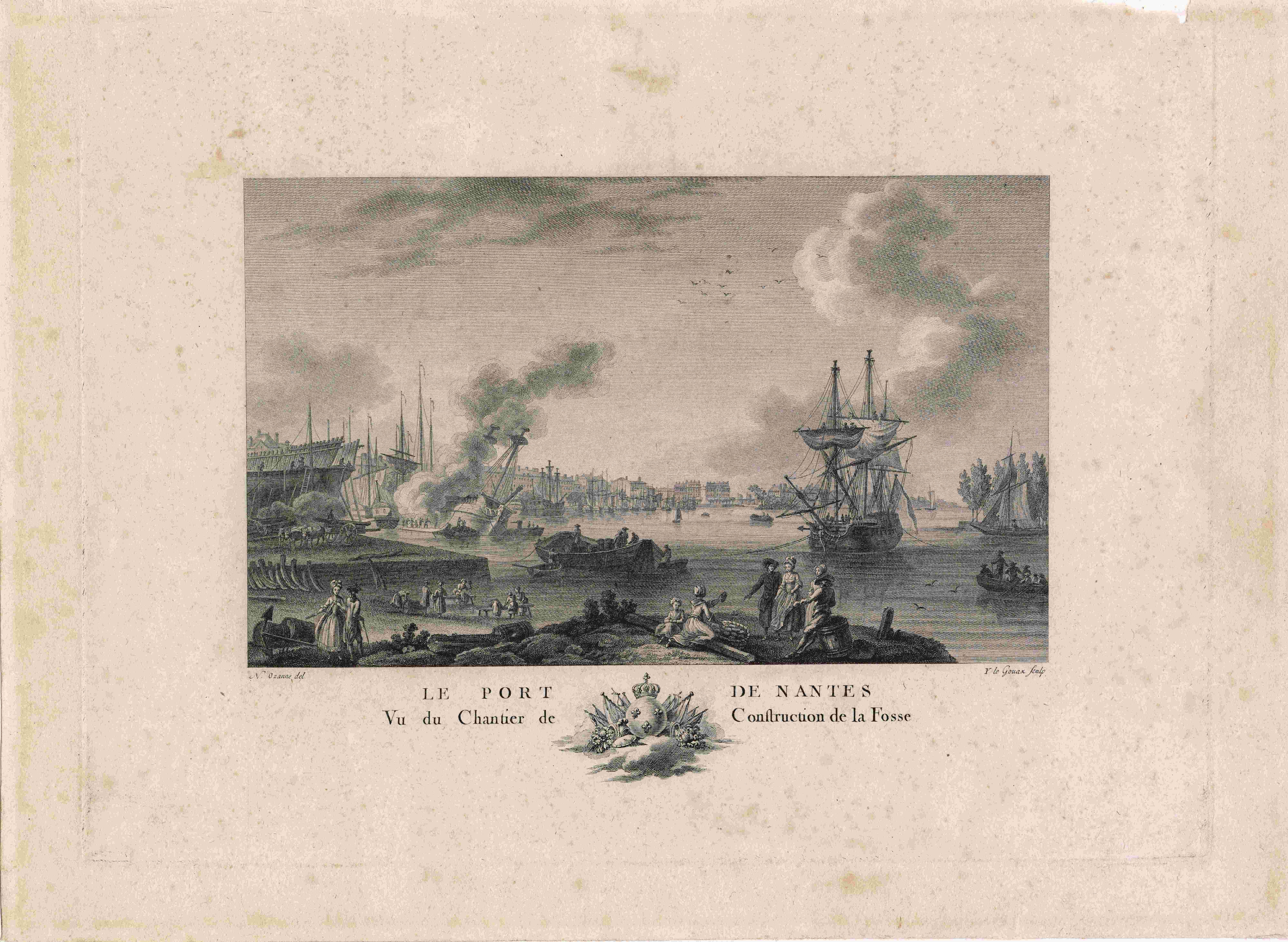
In 1776, a draughtsman for the French Navy, Nicolas Ozanne, produced a series of French ports’ views for King Louis XVI. He pictured Nantes as a booming port. A striking sign of this wealth was the development of impressive private mansions along the Quai de la Fosse. Both the construction and the preparation work on the hulls are faithfully captured in this engraving. However, the large three-masted ships depicted in the harbor are a personal interpretation : at the time, none of the large-tonnage ships were able to sail up to the port.
Notice : © Château des ducs de Bretagne – Musée d’histoire de Nantes
OZANNE Nicolas (1728-1811)
Le Port de Nantes vu du Chantier de Construction de la Fosse
[View of Nantes’ port from the Fosse Construction Site]
1776
Paper engraving, 27 x 36.9 cm
Château des Ducs de Bretagne, Musée d’Histoire de Nantes INV 970.2.23
Salorges Museum collection
Crédit photo : © Château des ducs de Bretagne - Musée d'histoire de Nantes